 London
Green Belt Way
London
Green Belt Way 
London
Green Belt Way
Public Transport access to the London Green Belt Way
Travel Websites you may find helpful to plan your journey. These include bus, train and walking routes:
Access to the Route of the London Green Belt Way from Railway Stations and Bus Stops
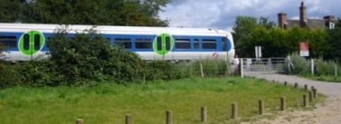 The Marlow Donkey
at Spade Oak
The Marlow Donkey
at Spade Oak
The table below gives a list of points where the route of the London Green Belt Way can be accessed from railway stations and buses. It lists the start and the finish points of each stage; has links to interactive stage maps; gives the places and distances in a stage which are easily reached from the relevant station and bus stop; how far this is from the station / bus stop and links to maps between the station / bus stop and the route of the walk. There are also links to the bus time-tables at these stops. This is not a comprehensive guide of all the stations and bus stops accessible from the route, but it does have most of the stations and bus stops reachable within a mile and a few slightly further. Please plan well and keep safe.
Please Note: There is a break between the end of stage 14 and the start of stage 15 because of the Dartford River Crossing, and information on a bus service across the Queen Elizabeth II Bridge, from the end of stage 14 to the start of stage 15, is also included. There is also a free service over the bridge for those cycling - see LINK
|
Stage |
Start of Stage |
Finish of Stage |
Interactive Stage Maps & Stage Distance (Miles) |
Rail Stations & Buses near the Route |
Distance into Stage in miles and (the point giving easy access to the Railway Station or Bus Stop). |
Distance from Station / Bus Stop to Route. Click on hyperlink for a map of route between the station and the Route of the Walk. |
|
1 |
Hampton Court Palace |
Staines Bridge |
13 miles |
0.0 (Hampton Court Palace). |
||
|
|
|
|
|
6.03 (Russell Road, Shepperton). |
||
|
2 |
Staines-upon-Thames Pier |
Windsor & Eton Riverside |
10.55 miles |
0.0 (Staines Pier). |
||
|
|
|
|
|
10.32 (Windsor, Thames Street). |
||
|
|
|
|
|
10.5 (Windsor, Thames Street / Datchet Road). |
||
|
3 |
Windsor and Eton Riverside Station |
Bourne End Station |
11.1 miles |
6.55 (Maidenhead Bridge, east side). |
||
|
|
|
|
|
6.64 (Maidenhead Bridge, west side). |
||
|
|
|
|
|
9.85 (Cookham, Stanley Spencer Gallery). |
||
|
|
|
|
|
11.1 (Bourne End Railway Bridge). |
||
|
4 |
Bourne End Station |
West Wycombe |
10.7 miles |
1.88 (Pound Lane, Little Marlow). |
||
|
High Wycombe National Rail & Bus Station. |
10.52 (West Wycombe Village Hall) |
See Map of BusStop See Bus Timetable |
||||
|
5 |
West Wycombe, Pedestal Roundabout |
Old Amersham |
12.25 miles |
High Wycombe National Rail & Bus Station. |
0.0 (West Wycombe, Pedestal Roundabout at the start of stage)
|
See Bus Timetable |
|
|
|
|
|
High Wycombe National Rail & Bus Station. |
2.25 (Hughenden Manor Church) |
See Bus Timetable |
|
High Wycombe National Rail & Bus Station. |
2.96 (Coombe Lane, Hughenden Valley) |
See Map of BusStop See Bus Timetable |
||||
|
6
|
Old Amersham |
St Albans |
8.1 miles |
Old Amersham does not have a train station. See below for nearest |
Bus Stop nearby in Old Amersham at Broadway and at Wheilden Street |
See Bus Timetable |
|
Amersham Station (National Rail & London Underground). |
0.5 (route crosses Station Road, Amersham - A416). |
|||||
|
|
|
|
|
Chalfont & Latimer Station (National Rail & London Underground). |
2.95 (Middle of Forest before Latimer - West Wood). |
|
|
7 |
Chipperfield |
St Albans |
9 miles |
Chipperfield does not have a train station. See below for nearest |
There are buses from next to Two Brewers at the start of the stage. |
See Map of BusStop See Bus Timetable |
|
2.9 (Junction of Water Lane / Primrose Hill). |
||||||
|
8 |
St Albans |
Hertford East Station |
15.15 miles |
0.0 (Start of Stage on Holywell Hill). |
||
|
|
|
|
|
6.43 (Great North Road, just over Wrestlers Bridge). |
||
|
14.66 (Castle Hall on The Wash, Hertford). |
||||||
|
9 |
Hertford East Station |
Cheshunt Station |
11.45 miles |
0.0 (Mill Road, just after Hertford Weir). |
||
|
Hertford Bus Station is nearby. See Map |
0.0 (Mill Road, just after Hertford Weir). |
See Bus Timetable |
||||
|
2.27 (Amwell End, next to Ware Bridge). |
||||||
|
|
|
|
|
4.35 (Station Road, St Margarets). |
||
|
|
|
|
|
5.7 (Rye Road, Rye House). |
||
|
8.51 (Old Nazeing Road, Broxbourne). |
||||||
|
10 |
Cheshunt Station |
Epping Station |
11.65 miles |
0.0 (Parking & Picnic Area 0.5 miles south of Cheshunt Lock). |
||
|
|
|
|
|
1.22 (Lee Towpath passes under Highbridge Street). |
||
|
|
|
|
|
2.45 (Lee Towpath just south of Smeaton Road bridge) |
||
|
|
Bus to Chingford Station |
Freddies Bus Stop just south of Godwin Close. |
3.7 miles (by Netherhouse Farm on Sewardstone Road) |
See Bus Timetable |
||
|
11 |
Epping Station |
Chipping Ongar |
7.7 miles |
0.0 Start of stage (Epping Station) |
||
|
12 |
Chipping Ongar |
Hutton Village |
12.15 miles |
For details of the "heritage bus service to Epping Station see LINK |
Also see details of the Epping Ongar Railway |
Good bus services from Ongar and direct bus back to Epping Station See Bus Timetable |
|
|
Bus back to Chipping Ongar & to Brentwood Station |
4.72 (Blackmore, The Green) |
See Bus Timetable |
|||
|
7.53 (Fryerning Green) |
||||||
|
8.59 (Trueloves Lane, just after Dunsteads Farm). |
||||||
|
|
Buses to Brentwood, Little Warley & Chelmsford |
9.43 (Mountnessing, The Plough pub) |
See Bus Timetable |
|||
|
13 |
Hutton Village |
Thames Chase Forest Centre |
10.85 miles |
Bus to Shenfield & Brentwood Stations and to Little Warley |
0.0 (Hutton Village, junction of Rayleigh Road and Hutton Village) |
See Bus Timetable |
|
Bus to Brentwood Station |
2.65 (Thorndon Park Gates, Brentwood Road, Ingrave) |
See Bus Timetable |
||||
|
Buses to Brentwood, Mountnessing & Chelmsford |
5.09 (Eagle Way, Little Warley) |
See Bus Timetable |
||||
|
5.09 (The Drive, Little Warley, just before Ford Building). |
||||||
|
10.29 (St Marys Lane, next to Thatched House Pub). |
||||||
|
14 |
Thames Chase Forest Centre |
Chafford Hundred Station |
11.0 miles |
Bus to Upminster Station, Davy Down & Lakeside |
2.16 (Corbets Tey, bus stops E & W. By the Huntsman & Hounds Pub) |
See Bus Timetable |
|
|
|
|
|
5.52 (Park Lane, Aveley) |
See Bus Timetable |
|
|
Lots of buses where we exit Davy Down Riverside Park |
8.28 (North Stifford, Caravan Park, on Pilgrims Lane) |
See Bus Timetable |
||||
|
11.0 (End of Stage at Chafford Hundred Station). |
0.0 miles |
|||||
|
|
|
|
|
Bus information for X80 from Chafford Hundred Station to cross Thames over the Queen Elizabeth II Bridge. There is also a free service over the bridge for those cycling - see LINK |
11.0 End of Stage 14 (you will need to know this information to cross the river to Stone, unless you have your own means of transport - get off the bus at the Stone Crossing) |
Stone Crossing is at start of Stage 15. You can start Stage 15 where you get off the bus. It's just 0.15 miles into the stage. |
|
15 |
Stone Crossing Station |
Dartford Station |
6.75 miles |
0.0 (Stone Crossing Station at the start of stage 15) |
|
|
|
16 |
Dartford Station |
Shoreham Station |
11.4 miles |
0.0 miles (Dartford Station at start of Stage 16) |
There is a direct train back to Stone Crossing Station. |
|
|
|
|
|
|
4.25 (Station Road, South Darenth). |
||
|
6.37 (Lion Hotel, Farningham) |
See Bus Timetable |
|||||
|
|
|
|
|
7.52 (T-Junction at south end of Sparepenny Lane). |
||
|
|
|
|
|
8.73 (Lullingstone Roman Villa). |
||
|
9.54 (Lullingstone Park Visitors Centre, Castle Road). |
||||||
|
|
|
|
|
11.3 (Station Road, Shoreham, from just before footpath to golf course at End of Stage 16). |
||
|
17 |
Shoreham Station |
Westmore Green, Tatsfield |
11.1 miles |
1.36 (onto High Street, Otford). |
||
|
There are lots of buses from the Pond, Otford |
1.36 (onto High Street, Otford). |
See Bus Timetable |
||||
|
|
|
|
|
3.12 (Rose & Crown pub, Dunton Green). |
||
|
|
Buses north to Bromley & south to Westerham |
8.91 (Westerham Hill, Pilgrims Way) |
See Bus Timetable |
|||
|
18 |
Westmore Green, Tatsfield |
Merstham Station |
11.05 miles |
Buses north to New Addington Tram & south to Oxted Station |
0.0 (Start of Stage 18, outside The Old Ship, Westmore Green) |
See Bus Timetable |
|
3.15 (Chalkpit Lane). |
||||||
|
19 |
Merstham Station |
Box Hill & Westhumble Station |
11.4 miles |
0.0 (Merstham Station at Start of Stage 19). |
0.0 |
|
|
Buses to Redhill, Reigate and Croydon |
0.14 (Feathers Hotel, Merstham). |
See Bus Timetable |
||||
|
2.56 (NDW crosses Fort Lane, just before Reigate Fort). |
||||||
|
|
Bus stop is 130 yards to left as we cross Boxhill Road. |
8.46 (Boxhill Road, Woodlands Park) Buses to Leatherhead, Dorking and Epsom |
See Bus Timetable |
|||
|
10.96 (Burford Bridge, Old London Road, above hotel) |
See Bus Timetable |
|||||
|
20 |
Box Hill & Westhumble Station |
East Clandon |
10.4 miles |
0.0 (Box Hill & Westhumble Station at Start of Stage 20). |
||
|
|
|
|
|
1.92 (On NDW at junction of tracks after tall gates). |
||
|
6.0 (NDW crosses Beggars Lane). |
||||||
|
21 |
East Clandon |
Walton Bridge |
12.45 miles |
Bus Stops are 200 yards apart & on both sides of dual carrigeway |
(Start of Stage 21. Epsom Road A246) Buses to Guildford, Epsom, Leatherhead, Effingham Junction, Leatherhead & more. |
|
|
0.16 (The Street, East Clandon, immediately before Queens Head pub). |
||||||
|
|
Buses to Woking, Guildford, Kingston & much more |
3.98 (Ripley Post Office, Ripley High Street) |
See Bus Timetable |
|||
|
7.31 (Wey Navigation at Old Parvis Road). |
||||||
|
|
|
|
|
7.81 miles (Junction of Wey Navigation and Basingstoke Canal - via Basingstoke Canal Towpath) |
||
|
|
|
|
|
8.84 (New Haw Lock) |
||
|
|
|
|
|
5.25 (Coxes Lock). |
||
|
|
|
|
|
9.98 (Weybridge Lock). |
||
|
22 |
Walton Bridge |
Hampton Court Palace Maze |
9.1 miles |
0.0 (Walton Bridge). |
||
|
|
|
|
|
1.81 (Lower Sunbury, junction of Thames Street & Green Street). |
||
|
|
|
|
|
3.9 (T-junction of Lower Sunbury Road and Upper Sunbury Road at Hampton Waterworks). |
||
|
|
|
|
|
0.0 (Hampton Court Palace). |
||
|
Total |
Hampton Court Palace Main Door to the centre of Hampton Court Maze |
Middle of Hampton Court Palace Maze |
238.4 miles |
|
|
|
Copyright @ Sean.Davis 1995 - 2023 All rights reserved. (Last updated 28 Feb 2023)